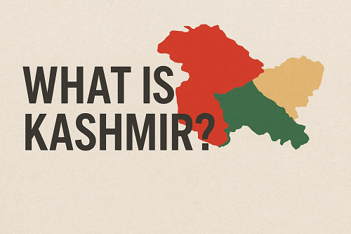
Kashmir, also called Cashmere, is a large area on the northern
border of India. Its official name is Jammu and Kashmir. Kashmir has
been the center of a dispute between India and Pakistan since 1947. Each
country claims Kashmir as part of its territory. The capitals of Kashmir,
by traditional use, are Srinagar in the summer and Jammu in the winter.
LOCATION, SIZE, AND SURFACE FEATURES
Kashmir covers an area of 85,806 square miles (222,237 sq. km).
Several ranges of the Karakoram and Himalayan mountain systems cut
across Kashmir diagonally from the northwest to the southeast. Two of the
world’s highest peaks, K2 (28,250 feet, or 8,611 meters) and Nanga
Parbat (26,650 feet, or 8,123 meters), are in northern Kashmir. For the
location of Kashmir.
The Indus river flows northwestward through Kashmir, separating
the two ranges of mountains. A tributary of the Indus, the Jhelum, flows
through the famous Vale of Kashmir. There, the climate is mild and the
soil well watered. The mountains have valuable forests.
THE PEOPLE AND THEIR WORK
About 7 million people live in Kashmir. Most of the people are
“Muslims, but about a fourth of them belong to other religions, including
Hinduism. Culturally, both the Muslims, and Hindus belong to the same
with the same language and custom. Most of the people work on
farms. Others work in small industries, making shawls, rugs, and carpets
group, from cashmere wool. All the farmland in the vale of Kashmir is under intense
cultivation. Cily about 6 per cent of the land in Kashmir can be used for
growing food and some farms are perched on the sides of hills. Corn and
rice are the maior crops, and there are many orchards and vineyards.
Roses and ja mire provide oil used in perfumes. Kashmir is also famed
for its wool a 1 stk.
HISTORY AND GOVERNMENT
Prior to British withdrawal from the subcontinent of India in
1947, an absolute monarch ruled Kashmir. In 1947 the subcontinent was
divided inte two nations: Pakistan (Muslim) and India (Hindu). The
division did not include Kashmir, where hereditary princes ruled. The
Maharaj of Jammu and Kashmir, a Hindu, tried to avoid joining either
India or Pakistan. Pakistani Muslims invaded Kashmir in an attempt to
unite Kashmir with Pakistan. The Maharaja met this threat by making
Kashmir a part of India. He formed a parliamentary government, and gave
of his powers to a cabinet.
War raged until 1949, when the United Nations arranged a cease
fire, and set up a truce line. The line left the northwestern third of
Kashmir under Pakistani control. Pakistan called this land Azad (Free)
Kashmir. The rest of the area was controlled by a pro-Indian Kashmiri in
a new assembly. The assembly abolished the 105 year old monarchy and
accepted a status of near independence in the Union of India. But a so-
called Free Kashmir Movement, made up of Muslims, refused to
recognize the changes.
In 1957, a new constitution became effective. It established
Kashmir as a part of India. Pakistan objected vigorously to any move that
seemed to link Kashmir more closely to India. Indian control over
Kashmir increased after 1957, but the area remained in dispute. China
occupied a small part of Ladakh in northeastern Kashmir in 1959. It seized
more of Ladakh in 1962. India and Pakistan held talks over Kashmir in 1963.
In August 1965, heavy fighting broke out again between India and
Pakistan. A cease fire went into effect in September. In January 1966,
Indian Prime Minister Lal Bahadur Shastri and Pakistani President
Muhammad Ayub Khan met in Tashkent, in the Soviet Union. They
resolved to try to settle their dispute peacefully. However, in 1971, civil
war broke out in Pakistan, and Indian forces again fought Pakistanis in
Kashmir. In 1972, after the war ended, a new truce line was established
between the Indian and Pakistani sections of Kashmir. Azad kashmir, quasi state in the Pakistani held sector of Jammu and
(“Free”) Kashmir, established in 1947 after the partition of India, is
Kashmir, in the northwestern part of the Indian subcontinent, Azad
neither a province nor an agency of Pakistan but has a government of its
that is regarded by Pakistan as “independent”, even though it is
protected by and economically and administratively linked to Pakistan,
has an area of approximately 650 square miles (1,680 square km) and
consists
of an are shaped stretch of territory bordering the Indian held state
of Jammu and Kashmir on the east, the Pakistani states of Punjab on the
south and southwest and North West Frontier Province on the west, and
the Gilgit and Baltistan agencies of Pakistan on the north,
Northern Azad Kashmir comprises foothills of the Himalayas
rising to Jamgarh peak (15, 531 feet 14,734m]; south of this are the
northwestern reaches of the Pir Panjal Range, which has an average crest
line of 12,500 feet (3,800 m), The Jhelum River and its upper tributaries,
including the Punch River, have cut deeply incised and terraced valleys
through these mountain ranges; the Jhelum also constitutes most of the
western boundary of Azad Kashmir, The southern part of the territory
consists of a narrow zone of plains country in the Punch region that is
characterized by interlocking sandy alluvial fans. Thorn scrub and coarse
grass are the dominant forms of vegetation in the south; this scrubland
gives way to pine forests at higher elevations in the north,
Wheat, barley, corn (maize), millet and live stock are raised in
the lower valleys and support relatively high population densities. In the
more sparsely settled upper valleys, corn, cattle, and forestry are the
economic mainstays. There are deposits of marble near Muzaffarabd and
Mirpur, graphite at Mohriwali, and other reserves of bauxite, silica,
chalk, zircon, and low grade coal, Household industries produce carved
wooden objects, textiles, and dhurrie carpets. The government of Azad
Kashmir has its headquarters at Muzaffarabad, which is linked by road
with Abbottabad to the southwest. Mirpur is the major town in the
southern part of the territory.
Kashmir, Vale of, scenic intermontane valley between the main
Himalayan ranges (northeast) and the Pir Panjal Range (southwest), in
northwestern India. The valley is an ancient lake basin 85 mi (140 km)
long, 20 mi wide, and 5,300 ft (1,620 m) high, Drained by the upper
Jhelum River, the valley is lined by 12,000-16,000 ft. highmountains that
help shelter it from the wet southwest monsoon. It is the centre of
population for the Kashmir area; Srinagar is the capital of the Indian held
sector of the state of Jammu and Kashmir,, The fertile alluvial soil yields
rice, corn (maize), fruit, and vegetables, and the scenic mountains and lakes (notably Wular and Dal) attract many tourists. The valley was the
resort of Mughal emperors, notably Jahangir, the early 17th century
emperor of Hindustan (northern India) who constructed picturesque
gardens and buildings for his empress, Nur Jahan. The vale is sometimes
referred to as the “happy valley”, perhaps because it gives a feeling of
isolation from the rest of the world.